Rehabilitating “Historical Map”
/It’s time to end a confusing prescription good only for academic gate-keeping
Some years ago, I was in a meeting with a group of colleagues, most of them map historians of long standing, and all good friends (of mine and of each other). In the middle of some discussion, the one younger colleague in the room referred to our field of study as “historical cartography.” Immediately, all the rest of us shared a knowing look and re-asserted our communal superiority. None of us said anything to correct the speaker—that would have been too embarrassing. Rather, we sat secure and self-satisfied that we knew the proper term for the field: “the history of cartography.” To refer to the field as “historical cartography” meant that our young colleague was either intellectually conservative or unable to get with the line with several decades of conceptual change and debate (not the case) or a complete newb. [n1]
The same kind of response is elicited whenever someone uses the phrase “historical map” for a map that is the subject of historical study. Just last week I found myself correcting the author of an essay submitted to a journal that I had been asked to review. It’s not “historical map,” it’s an “early map.” Incorrect usage is a sign of the newcomer or of someone more established who nonetheless lacks the credentials to be part of the ingroup.
Why should scholars who otherwise pride themselves on being open and friendly to newcomers react in this smug, conceited, and quite invidious way? The required usage has become a shibboleth that sustains an adverse group dynamic (also Crespo Sanz and Fernández Wyttenbach 2011, 403, 416).
The situation is especially problematic because the terminological prescriptions are in fact artificial and fly in the face of intuitive elements of language. We should abandon the prescriptions and learn to re-embrace “historical map” as a completely valid and appropriate term. (“Historical cartography” remains inadequate, but then so is “history of cartography.”)
Skelton’s Terminological Prescriptions
In his 1966 Nebenzahl Lectures (published posthumously as Skelton 1972), the leading British map librarian and historian R. A. Skelton engaged in an act of terminological prescription. Like Armando Cortesão (1969, 4), who was writing at the same time at the same time that Skelton was preparing his lectures, Skelton was concerned to establish “the history of cartography” as an autonomous field of study that was not a handmaiden to any other field of study. Both scholars sought in particular to distinguish the study of maps from the past from the study of maps made about the past. Cortesão’s terminology did not catch on, but Skelton’s did. Here’s the key phrase:
Just as “historical geography” is not the same thing as “the history of geography,” so we must not confuse “historical cartography” with “the history of cartography” (or “cartographic history”). Historical geography and cartography are procedures by which geographical circumstances of the past are reconstructed, or detected in those of the present. The history of geography and the history of cartography trace the development of man’s knowledge and ideas about the earth and the graphic forms in which he has expressed them. (Skelton 1972, 62)
An “historical map” is therefore a map made about the past and, as Skelton further noted, is itself subject to study within the history of cartography. Peter Meurer (1998), for example, reviewed Abraham Ortelius’s personal design and production of maps of the Classical and Biblical past in the later sixteenth century:
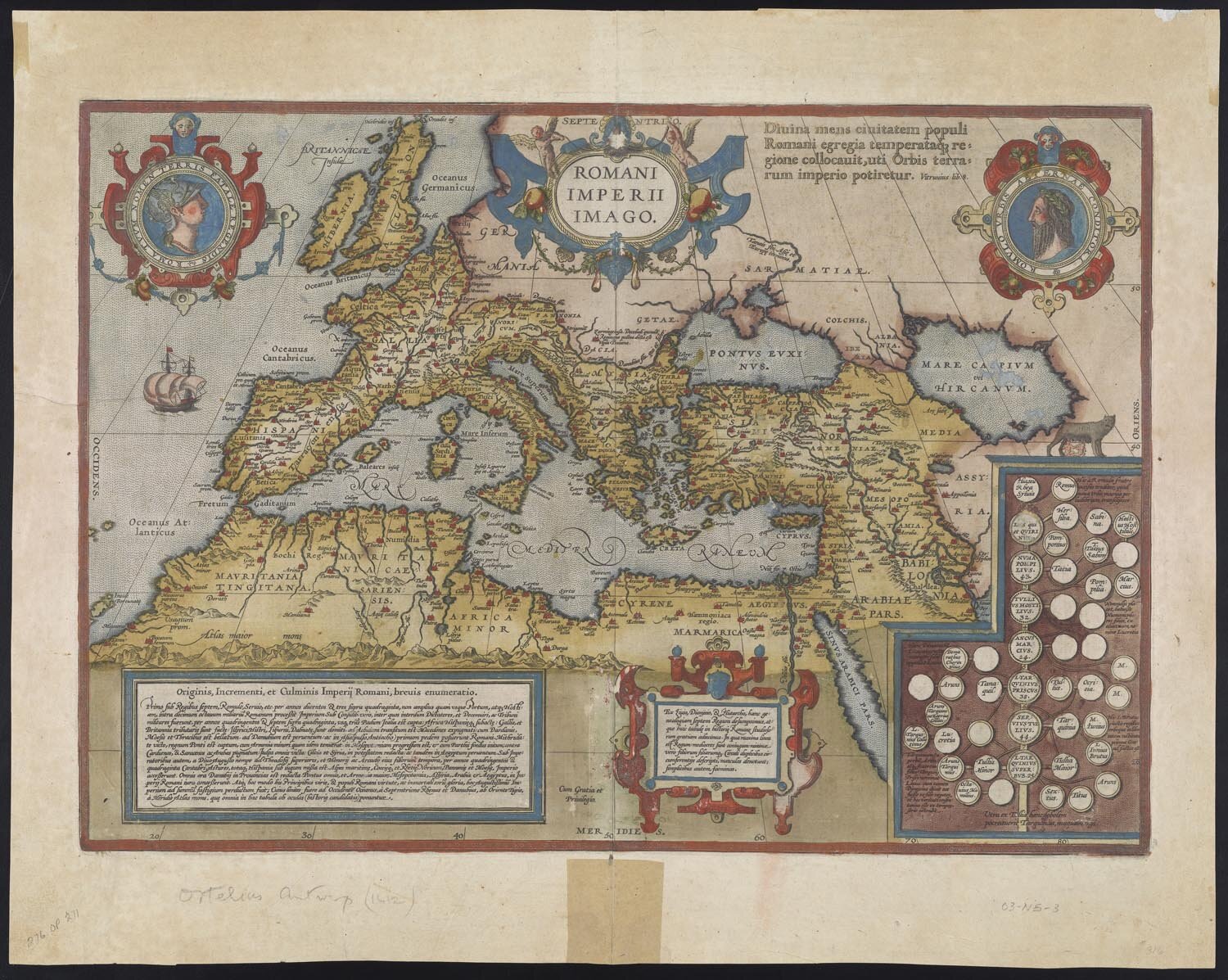
Abraham Ortelius, Romani Imperii Imago (Antwerp, 1598). Map of the Roman Empire: a quintessential “historical map.” Hand-colored copper engraving, 35 × 50 cm. Osher Map Library and Smith Center for Cartographic Education, University of Southern Maine (Smith Collection); click on image to see in high resolution.
Skelton’s terminology was extensively promoted by two of his mentees: David Woodward, who had been in Skelton’s audience, and Brian Harley. Harley and Woodward were equally concerned to establish map history an academic discipline in its own right—at a time when many were arguing that “cartography” itself should be an independent discipline (Wolter 1975). Skelton’s expansive conception of the field was very appealing to them and they pushed it accordingly. Henceforth, if one adhered to the Harley-Woodward agenda for the field, then one called it “the history of cartography” and kept it thoroughly distinct from the practice of making maps about the past, “historical cartography.” Moreover, one must use terms for a map from the past other than “historical map.” Tony Campbell thus began the introduction to his Gateway to “Map History/History of Cartography” with the statement:
Old maps, early maps—non-current maps in general—are the subject of this site.
Linguistic Ambiguities
Historical
Western European languages are actually rather imprecise about time, whether the future or the past. They possess a degree of grammatical flexibility in which a verb can be used in the present tense to refer to the future or the past. Linguists are apparently deeply intrigued by the manner in which the Italian phrase, le mappe di città vecchie, can mean either “the old maps of cities” (i.e., maps from the past) or “the maps of old cities” (i.e., maps made now about cities in the past) (Liberman 2013). In English, “historical” means “from or about the past.” (As opposed to “historic,” which refers to significance in the past…or in the present! )
It is natural to use “historical map” to mean a map from the past:
• for any newcomer to the field;
• for anyone whose first language is not English; or
• for cognoscenti themselves when they slip up (easy to do).
So why should we get hung up on the correct use of “historical map”?
Why try to enforce a usage that our language actively discourages?
The only valid answer is to keep the gates to the field.
Early/Old/Ancient
The alternatives to “historical map” in referring to maps that are being studied from an historical perspective (ahem!) is generally “old map” or “early map.” The issue is that these terms come with implications and connotations that can be somewhat misleading.
In particular, these terms are relative. “Early” and “old” with respect to what? When the ideal of cartography developed in the early nineteenth century, it entailed an historiographical act. The ideal distinguished between the new system of cartography now and older forms of map making (still called cartography but not cartography per se) then. A map was a modern map; other kinds of maps had to be qualified as “early” or “old.” These distinctions were not formally defined. Skelton (1965, 27) suggested that an “early map” was, in a chronologically vague, pre-modern sense, “any map which, through immaturity of knowledge, judgment or expression, is not to be read as a strict record of geographical fact.” Finally, the International Cartographic Association defined “old” and “early” in the following ways.
A carte ancienne / frühe Karte / early map was one “produced before the first systematic survey of the area it represents,” which is to say a map made without the benefit of modern cartographic practices. (Meynen 1973, §815.2)
An alte Karte / old map—no French equivalent specified—can be “loosely” defined as one “produced before the middle of the nineteenth century” (Meynen 1973, §815.1; also Crespo Sanz and Fernández Wyttenbach 2011, 416)
The absolute division suggested by the ICA definition of “old map” has had to be modified as map scholars have turned an historical eye on maps and mapping post-1850. For example, Ivan Kupčík (1981, 233–34) used 1850 to demarcate old from modern mapping but shifted the divide to 1900 in a later edition (Kupčík 2011, 173).
The ICA definitions are meaningful only from the retrospective point of view required by the ideal of cartography. The assumption of “early map” is that once a systematic territorial survey is complete, then all maps (true maps) are properly derived by simplifying and generalizing that survey. “Old” maps are those made before the general establishment of modern cartographic techniques (and the rise of “thematic mapping”). By the ICA definitions, the following map of France is neither early nor old:

Map of France from van Loon (1932).
But then again, it’s not the kind of map that would have been permitted entry into the hallowed halls of cartography.
Even so, the generally preferred term among adherents to Harley and Woodward’s disciplinary vision is “early map.” This is the term that I generally use. And it’s fine and dandy, until I used it in the chapter of Maps, History, Theory dealing with early modern encounters of maps and the past. One issue is that before 1800 or so, the understanding of “history” was limited to certain kinds of work (synchronic inventories or diachronic narratives); there was no general understanding that “history” referred to “the past.” This and the fact that interest in maps from the past was sporadic mean that it is difficult to identify anything like a coherent field of study as “map history.” Moreover, maps from the early modern period are themselves “early” from the perspective of a map historian writing today. So when I write “antiquaries were interested in early maps,” do I mean antiquaries were interested in maps from previous centuries (early to them) or in any maps from their period (early to us)? This might seem a weird problem, but it thoroughly confused one reader of the chapter! This point also misled both Skelton (1972) and Harley (1987) to suggest that the growth of map collections in the eighteenth century constituted an engagement with map history, although the map collecting was of contemporary maps.
Another term might be “antiquarian,” but this can be interpreted as referring specifically to the kinds of maps bought and sold through the antiquarian marketplace, and as excluding most anything else. (Although map dealers today have a very broad and untraditional stock.) Also, “antiquarian” has certain negative connotations.
The French ancien (and the Spnish antigua) is occasionally translated into English as “ancient,” but in English this word is used to refer to Antiquity, which might be any time prior to the fourth century (BCE or CE, depending on which Classicist or ancient historian you talk to). So, not generally useful.
Stop the Gate Keeping
Why not use “historical map” for any map that one wants to consider and study historically? The only reason not to do so is gate keeping. There are two aspects to this gate keeping.
The first is to keep the study of maps from the past distinct from the making of maps about the past. In practice, this is a difficult divide to maintain, especially in the present-day context of “digital humanities.” And, of course, Skelton’s prescriptions have not been adopted by everyone.
The second form of gate keeping is to distinguish within map studies between the study of historical and contemporary maps. The insistence that “early maps” are non-current (in Tony Campbell’s phrase)—that they “have lost their initial use (political, military, as an administrative or government tool, etc.)” (Crespo Sanz and Fernández Wyttenbach 2011, 405), as in the ICA’s definition of “old map”—establishes an intellectual and chronological divide that replicates the ideal of cartography, that the production of maps now is somehow different from that of maps then.
But history, like any other kind of scholarship, is a process: how we look at things when we think of them as being “of the past.” There is nothing to say that such a process is irrelevant to contemporary mapping in the present-day. This is, of course, the whole point of “critical cartography” and “critical GIS.”
Mapping is a process. We must therefore avoid the essentializing and idealized conception “cartography.”
What is often called “historical cartography” now—the making of maps about the past—is really a kind of analytical mapping (Schulten 2012). (For why I prefer to talk about “analytical” rather than “thematic” mapping, see my earlier posting, Why I don’t like thematic maps.) One can avoid confusion by referring to such works as analytical maps. Or be clear in context; in writing about a work called an “historical atlas” in its title, as in The Times Atlas of World History, it should be easy, for example, to indicate what kind of historical work one refers to.
The process of mapping deserves to be studied as a process: so, why not refer to maps considered in an historical manner as “historical maps”? Without expectation that this sets up a sharp distinction between the past and the present. (The past begins a second ago!)
Notes
n1. “Newb” is short for “Newbie,” i.e., a newcomer, an inexperienced person. Urban Dictionary notes that “newb” differs from “noob” in that a newb is someone who actually wants to get better.
References
Cortesão, Armando. 1969. “Cartography and Its Historians.” In History of Portuguese Cartography, 1:1–70. Agrupamento de Estudos de Cartografia Antiga, 6 and 8. 2 vols. Lisbon: Junta de investigacões do ultramar.
Crespo Sanz, Antonio, and Alberto Fernández Wyttenbach. 2011. “¿Cartografía antigua o Cartografía histórica? / Old cartography or historical cartography?” Estudios Geograficos 72, no. 271: 403–20.
Harley, J. B. 1987. “The Map and the Development of the History of Cartography.” In Cartography in Prehistoric, Ancient, and Medieval Europe and the Mediterranean, edited by J. B. Harley, and David Woodward, 1–42. Vol. 1 of The History of Cartography. Chicago: University of Chicago Press.
Kupčik, Ivan. 1981. Cartes géographiques anciennes: Évolution de la représentation cartographique du monde, de l’Antiquité à la fin du XIXe siècle. Translated by Suzanne Bartošek. Paris: Gründ.
———. 2011. Alte Landkarten von der Antike bis zum Ende des 19. Jahrhunderts: Ein Handbuch zur Geschichte der Kartographie. 8th ed. Stuttgart: Franz Steiner Verlag.
Liberman, Mark. 2013. “(Not) Trusting Data.” Language Log, 4 August 2013.
Loon, Hendrik Willem van. 1932. Van Loon’s Geography: The Story of the World We Live In. New York: Simon and Schuster.
Meurer, Peter H. 1998. “Ortelius as the Father of Historical Cartography.” In Abraham Ortelius and the First Atlas: Essays Commemorating the Quadricentennial of his Death, 1598–1998, edited by Marcel P. R. van den Broecke, Peter van der Krogt, and Peter H. Meurer, 133–59. ’t Goy-Houten, Netherlands: HES.
Meynen, Emil, ed. 1973. Multilingual Dictionary of Technical Terms in Cartography / Dictionnaire multilingue de termes techniques cartographiques. Wiesbaden: Franz Steiner Verlag for the International Cartographic Association, Commission II.
Schulten, Susan. 2012. Mapping the Nation: History and Cartography in Nineteenth-Century America. Chicago: University of Chicago Press.
Skelton, R. A. 1965. Looking at an Early Map: The Annual Public Lecture on Books and Bibliography, University of Kansas, October 1962. University of Kansas Publications, Library Series 17. Lawrence: University of Kansas Press.
———. 1972. Maps: A Historical Survey of Their Study and Collecting. Edited by David Woodward. Chicago: University of Chicago Press.
Wolter, John A. 1975. “The Emerging Discipline of Cartography.” Ph.D. dissertation. Geography. University of Minnesota.


