Constructing a Feminized Landscape
/This is a gathering, reorganization, and expansion of a thread I posted on Twitter earlier today.
The wonderful map dealer Barry Ruderman shared an image last night of, I think he said, the first map to use “Beverly Hills” in the title. He has given me permission to use it here. The map was a “Map of Portion of Beverly Hills” issued in November 1906 as a real estate development plan:
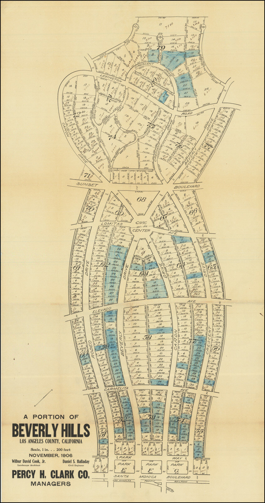
What sets this map apart is the manner in which the development was shaped in the form of an attractive woman. Local lore maintains, Barry further added, that the development was modeled on the It Girl, Clara Bow, although Ms Bow was born only in 1905 and her photo shoots generally did not feature the demure Edwardian dress that the development imposed on the landscape and depicted in the map.
Sunset Boulevard forms a high waist. Running along the foot of the hills, the boulevard separates the hills above from “The Flats” below, reaching down to the Santa Monica Blvd. Here’s the area in Google’s terrain layer:

The rather suggestive (if anatomically mnislocated) triangle of green on the modern map is the Will Rogers Memorial Park, pointing down to the 1906 plan’s more correctly suggestive “Civic Center.” In the end, the six-way circular junction remained thoroughly residential.
Above the waistline, the development lets the landscape itself present a female bust; below, the plan relies on curving roads to draw the edges of the skirt. As the image clipped from Google Maps suggests, those curves have been paralleled by later roads.
The imposition of a female figure on the landscape that is to be objectified, fetishized as small plots of property, and ultimately possessed needs little further comment. Had the map been intended to be a network, then its features would have been coded as male. But the possession of landscape requires a male gaze to possess the female.
Thanks, Barry.


